Sunday, November 20, 2011

Big Creek Summit - Great Touring but No face shots yet

Saturday 11.29.2011, at McCall, we had a very successful NSP Southern Idaho and Eastern Oregon Avalanche Instructor conference. Many participants across the region showed great enthusiasm, and we ALL learnt a lot about winter weather, snotel, Avalanche Fracture Mechanics, Decision Making, and reviewed NEW concepts about Avalanche Rescue. Special Thanks to Julie and Jeff from the Boise NRCS (the Idaho SNOTEL guys). Their Winter Weather 101 course and SNOTEL workshops were "facet-nating"! :)

The Event concluded with a tutorial on how to apply the Anti-Crack theory in the evaluation of avalanche instabilities. This theory continues to gain popularity among Avalanche professionals as field data supporting it continues to accumulate, and the Shear Failure Theory is abandoned for its serious inconsistencies explaining propagation and effect of slope angle. A sample slide of the Stability Quadrants resulting from the Anti-Crack theory is included below:


And to conclude this event, Dave Bingman from the Payette Avalanche Center and Keith Stebbings from Eastern Oregon's Wallowa Avalanche Center shared the centers accomplishments for Winter 2010-2011. They also previewed this upcoming season exciting new products and outreach programs.

After a very busy Saturday, we spent Sunday touring the Big Creek Summit area East of the Warm Lake Road. It was a wonderful day, with a very cold start, but warming up nicely later in the day.

Stephen, Brad, Joe - Big Creek Summit
The snowpack depth was generally uniform with a depth ranging from 40 to 50 cm. Of course, not enough to cover deadfall and rocks, but sufficient for an splendid day of touring. After the storm left the area Saturday night, and the skies cleared up, the snowpack released its long wave radiation (infrared spectrum - heat) to the very cold dark sky. The humid air from the storm immediately above the VERY cold snow surface could not retain the water molecules. This is due to the reduction in molecular kinetic energy that reduces the intermolecular spacing in the air. Thus, the water vapor molecules, having no place to go, are deposited as "Surface Hoar". This SH was widespread and it was present at all aspects/elevations during our tour. The only exception was on treed areas, were the dark night sky was blocked by the trees.

During the day we observed also the formation of "Near Surface Facets"(NSF) at West and South aspects due to the cold snow and the warm afternoon. Much later in the day, at lower elevations and south aspects, we noticed the formation of a melt recrystallization NSF. WOW! SH, as well Diurnal and melt recrystallization NSF in a single day. But it does not ends there, as expected there were some (not too much) depth hoar (DH) crystals at the bottom of the snowpack.

In an attempt to anticipate instabilities during the next storm (Wednesday), Loaded Column and Shovel Tilt Tests identified a sensitive layer buried 4 cm from the snow surface. The layer consisted of NSF and precipitation particles (stellars and columns). It is possible that this layer was formed as temperatures plummeted late Friday November 18th, additional snow was deposited later on Saturday. This can be easily detected from the graphical snotel data for precipitation and temperature.

Big Creek Snotel Data

Notice that similar temp/precip can be observed at Banner summit for the same time interval.

Banner Summit Snotel Data

The buried NSF buried layer, as well as the surface hoar present, can be of concern if the weather delivers sufficient snow this wednesday to load the weak layers.
60-70% Probability of more than 15 cm for Wednesday 11/23/2011
The forecast for the next storm affecting Central Idaho is for a 60-70% probability of more than 15 cm of snow. We will have to keep an eye on precipitation intensity, total amounts, and particularly wind!

Furthermore, there were many "wumpfs" today as we skinned up. We believe that there were the result of collapsing snowpack as it sintered and gained cohesiveness (became slab), and not an indication of basal instabilities. The snowpack at the places we toured (6,000-7200 feet) had very little to none depth hoar. But as we get more snow (upcoming Wednesday) and the snowpack is loaded, I cannot stop thinking if these collapses can indeed trigger releases at the SH or NSF buried weak layers.

This next storm cycle will require a lot of our attention. And we all want to do pow turns, but it will be prudent to keep those angles shallow. Keep in mind that there are plenty of rocks/deadfall as well as the SH and buried NSF. Act conservative!

Thursday, November 17, 2011

Christmas Present Ideas for Backcountry Ski Tourer

I hope this message is shared by fathers, mothers, sons, girlfriend, or wife searching for a GREAT present for their love ones that happen to love to spend time in the sidecountry or backcountry during the winter months. This is the time when we become desperate for that elusive gift. I will include below some ideas of MUST have gear:

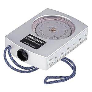
Sight-through Clinometer:

I noticed that the Brunton is priced at $74.59 - WHAT a DEAL!

AMAZON Link for Brunton Clinometer

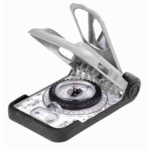
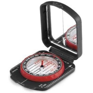
A slightly cheaper option but very functional, and you get a compass (must have item) is priced at $45.55:


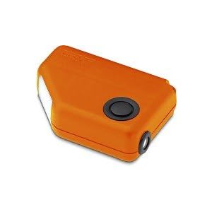
And finally a NEW item in the market with a very competitive price at 34.99:

Amazon Link for NEW Brunton Avalanche Inclinometer


There are other more expensive options, but I strongly recommend owning one of the above. For those that have are lucky to be love by the winner of the powerball I will include below the "Cadillac" of the clinometers:

Amazon Link for Haglof Clinometer


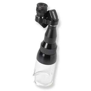
Magnifier for snow crystal identification:

STOP looking around, search no more, this is the best deal so far:

Amazon Link for Carson MA-30 Magni Scope Pocket Microscope


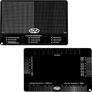
But if you get the scope, why not getting the BEST crystal card available? I do not recommend metal crystal cards - it is very hard to keep them from melting snow grains.

Amazon Link for BCA Crystal Card


Snowpit Technologies "Snow And Avalanche Field Notebook, 3rd Edition":

This is fantastic snow journal will keep your love one safe. It will help him/her to keep track of snow and avalanche conditions. It also has a lot of great information about stability tests, and other critical information. it is priced at $25.

Link for SWAG Field Book

Most likely your love one already has a Two-antena Transciever, a metal shovel with extendable handle, a 3 meter probe, and a snow saw. If not, what are you waiting for? Or if the probe or shovel have many miles or are reaching 10 years - go ahead an buy NEW reliable gear. Please make a note on buying a shovel with extendable handle, the new excavation techniques for avalanche rescue benefit from this feature.

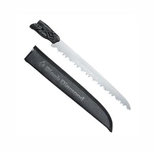
A note on snow saws, I recommend a snow saw that can cut wood in an emergency. A nice feature - my preference - is the option of connecting the saw to poles available in the BD snow saw.

Amazon link for Black Diamond Saw


Snow Cord:

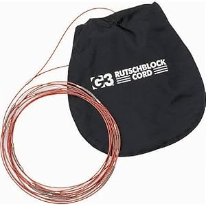
As we continue to educate backcountry users to use extended compression columns for snow stability evaluation, it is much easier (and fun) to use a snow cord to isolate the 90x30 cm snow columns:

Amazon link for G3 Cord


Avalanche Books:

Finally, the latest edition of Bruce's book has been updated, and it FUN to read.

Amazon Link for Staying Alive in Avalanche Terrain


Another book I strongly recommend is Snow Sense 5 Edition. I could not find a link at Amazon that will guarantee the 5th edition. And you want to GET this last edition! Thus I recommend that you use the following e-mail for ordering the book:

snowsensebook@gmail.com

If I come out with other gift ideas, I might come back and edit this posting.

Tuesday, November 15, 2011

More Snow Forecasted for Next Weekend -11.15.2011 Update

The Wx Forecast discussion from NOAA for our area is looking promising. more snow is coming!

Below an excerpt for Today's Long Term Wx discussion:

FRONT WILL EXIT TO THE EAST ON FRIDAY...BUT SNOW SHOWERS WILL PERSIST AS THE UPPER LOW DIGS OVER IDAHO. CENTRAL IDAHO MOUNTAINS LOOK TO RECEIVE THE BRUNT OF THE SNOWFALL. UPDATED SNOWFALL FORECAST /STORM TOTAL/ PUTS 5 TO 8 INCHES OF NEW SNOW IN THOSE MOUNTAIN VALLEYS...AND UPWARDS OF 18 INCHES ON HIGHEST MOUNTAIN PEAKS.

There is a nice tool I like to use, and that I shared last season with my blog friends. The probabilistic model results for this Thursday through Friday period is included below:
HPC Experimental Probabilistic Winter Precipitation Guidance

48 hour Probability of SNOW Accumulating more than 12 in. (30 cm)
for period ending Friday november 18th
BC Skiing this upcoming Saturday promises to be good at places where a base has been building due to last weekend precipitation event. Notice that in the chart above, the West Central and Boise Mountains have a 50-60% chance of more than 30 cm of NEW snow.

As you are heading out this weekend, make certain that you keep in mind the following pointers:
  1. NEW batteries for transceiver, and headlamp in you pack. Better, practice with your transceiver this week. No need to bury it, have a friend/wife hang it indoors above sight line and look down during the search.
  2. Inspect your aluminum shovel with extendable handle. Al shovels tend to develop stress crack, replace if you detect any. If you have a plastic/lexan shovel use it for dog poop or other tasks - then BUY a new shovel. Check your 3 meter avi probe. If you have anything shorter, help local businesses and BUY a new probe!
  3. Make the habit of checking Wx and AVI forecasts, links are provided on this BLOG! 
  4. Check your 1st aid kit and Emergency gear such as fire starting material, bivy sack, puffy coat, extra gloves, energy bars, leather-man tool.
  5. Take a close look at he bindings condition ... you don not want to have a failure while touring.
  6. Get a SWAG Blue Book or journal for Wx/Avi obs. Start this weekend by looking at the snowpack and recording observations.
  7. Verify that your INCLINOMETER is in your ski pants or coat! If you do not have one - BUY ONE PRONTO! 
  8. Print topo map of area to you plan to tour this weekend, study it, think where you want to go, and stash it in your coat. If you are feeling nerdy, study benefits of UTM coordinates.
As some of you know, the avalanche danger early in the season is accentuated due to the shallow snowpack and formation of basal facets (depth hoar) at the bottom of the snowpack. In addition there has been a lot of wind transport and windslab formation during the last weekend two storms. This upcoming Thursday/Friday snow loading event will surely stress the snowpack!

This is a good time to visit those low angles slopes we always wanted to explore, and/or time to go on outing to verify overall equipment performance - check skins, new boots, backpack, ... TAKE it EASY!

PS:

This Saturday - November 19th, there is a NSP instructor Conference organized by the South Western Idaho and Eastern Oregon Region NSP Avalanche Education Team.

This event is open to the public.

The event is at the Best Western in McCall, and starts at 9 AM. We hope to finish by 4 PM. There will interesting talks about Snotel Tools, Winter Weather 101 workshop, Decision Making and Avalanche Fracture propagation, talks by the region Avalanche Center directors (Payette and Wallowa Avalanche Centers), and the best part; you get to meet folks interested in advancing avalanche eduction in our area.

Sunday, November 13, 2011

Copper Mountain - November 13 2011

This last weekend, two winter storms jump started the Backcountry skiing season in Idaho. After snotel encouraging reports of new snow overnight at Banner Summit, it made sense to pay a visit to Copper Mountain.

Idaho City Visitor center on the drive to Banner Summit - Copper Mountain

For Copper Mountain North-West, West and South aspects, at 7000 feet the snow depth was 20-25 cm, at 8000 feet 25-30 cm, and less than 20 cm above 8500 feet due to wind transport.

The new snow was ~10-12% dense, and it will make a great "starter" base. In fact the new snow was exceptionally well distributed below 8000 feet, and if we get the additional snow forecasted through this week, and if we very lucky to exceed the 50 cm total snow depth, the skiing lower in the mountain might be the best November BC skiing at Banner Summit for the last 5-6 years!

However, I need to emphasize that if we do not get NEW snow, the skiing at Copper Mountain will remain dangerous due to MANY buried obstacles, as it can be observed in the video included below:


In order to maximize "float" and not destroy my Wateas skis with rocks, logs, frozen dirt, I resisted the temptation to ski steeper terrain and mostly skied low angle slopes.

The coverage below Copper Summit was poor and I decided not to summit. There is not enough snow, and it would have required walking down. It is likely that most of the snow from the South face was blown into the N and NE slopes facing the Sawtooth valley.

Coper Mountain Summit behind the fog.

Not surprisingly, above 8000 feet, where the new snow was sitting in top of facetted snow and/or wind driven snow from Saturday windy front, it was easy to hear the snowpack whumpfing (collapsing!). Also, in the flats at 7000 feet sporadic whumpfs were produced too due the formation of soft slabs (snow settlement and snow grains rounding & sintering resulting in densification of the new snow).

Be mindful of buried depth hoar early in the season due to shallow snowpack. Whumpfing suggest that there is fracture propagation propensity, and that a human is likely to trigger an avalanche if the terrain is steep enough.

By the way, avalanches at Alta-Utah became a problem this Sunday afternoon. And another rider died at Snowbird:


http://www.sltrib.com/sltrib/news/52907844-78/avalanche-resort-kobernik-ski.html.csp


http://www.sltrib.com/sltrib/news/52906292-78/avalanche-kobernik-storm-area.html.csp


After a wintry storm made driving dangerous Sunday morning, an unstable snowpack made skiing hazardous Sunday afternoon.

Four avalanches were reported Sunday afternoon, with one person suffering a leg injury, said Brett Kobernik, an avalanche forecaster with the Utah Avalanche Center.

Three of the avalanches were definitely human-triggered, and it appears likely the fourth one was as well, according to Kobernik.

All four were in the Alta Ski Resort, which has not yet opened for the season. Skiers need to treat the resort as a backcountry ski area because there are no ski or avalanche patrols, he said.

The layer of snow that fell in October is weak and sugary and now covered with heavier snow from the recent storm.